State Forest State Park
State Park in Walden, CO
Hours:
Office: Summer - Daily, 9 a.m. to 5 p.m.; Fall - Daily, 9 a.m. to 4 p.m.; Winter - 9 a.m. to 4 p.m., closed Wednesdays
Entrance Fees:
Daily Vehicle Pass: $12-$17
Animals Permitted:
- Leashed Dogs
- Service Animals
- Horses
Park Address:
56750 Highway 14
Walden, CO 80480
United States
Jackson County: Stage 2 Fire Restrictions -
Jackson County, including State Forest State Park, is under fire restrictions until further notice. Building, maintaining, attending, or using an open fire, campfire, or open flame outdoors is PROHIBITED, including in developed campgrounds & picnic areas. This includes charcoal grills, BBQs, coal, & wood-burning stoves. Learn more.

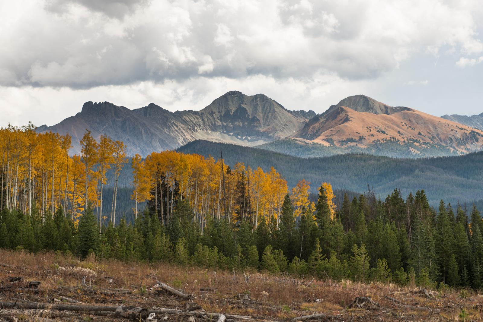
Gold aspens mixed with pine trees cover the mountains under a cloudy blue sky.
Welcome to State Forest State Park
In the ultimate rugged Colorado, State Forest State Park offers visitors 70,932 acres of forest, jagged peaks, alpine lakes, wildlife and miles of trails. With so much space and natural diversity, visitors can experience a wide array of outdoor recreational favorites such as camping, hiking, wildlife viewing and geocaching.


70,932
acres
228
campsites
14
picnic sites
136
miles of trails
Accessing the Park
Directions
From Denver
Take I-70 to the Empire exit, Highway 40, over Berthoud Pass through Winter Park and Granby. Two miles west of Granby, take Highway 125 for 45 miles to the east side of Rand. Take County Road 27 for 14 miles to Highway 14. Turn right and follow for three miles to the park.
The State Forest Visitor Center is located one mile east of the town of Gould, on the right side of Highway 14.
Hours:
Summer: Daily, 9 a.m. to 5 p.m.
Fall: Daily, 9 a.m. to 4 p.m.
Winter: 9 a.m. to 4 p.m., closed Wednesdays
North Michigan Reservoir Boat Ramps
Two boat ramps are located on the north side of the reservoir off Highway 41.
No watercraft of any type are allowed on Ranger Lakes.
For more information on the boat ramps and mandatory boat inspections, see the Park Highlights page.
Conditions
Fires - Jackson County, including State Forest State Park, is under Stage 2 fire restrictions until further notice. Building, maintaining, attending, or using an open fire, campfire, or open flame outdoors is PROHIBITED, including in developed campgrounds and picnic areas. This includes charcoal grills, BBQs, coal, and wood-burning stoves. Learn more.
Closures
Trails
The Michigan Ditch Trail and segments of the American Lakes Trail is closed to all users through late fall. The closures are in place for public safety while work on the Michigan Ditch Pre-Fire Mitigation Project is being completed in the Michigan Ditch drainage by Colorado State Forest Service and the City of Fort Collins. Read the news release for more information.
Custer Draw Road Transportation Regulations/Closure
Hunters and all State Forest State Park users, be aware of the Custer Draw Road electric & motorized use regulations.
County Road 41 Entrance to Custer Draw Regulations
Electric & motorized modes of transportation are PROHIBITED except for big game retrieval. Only electric & motorized modes of transportation with a width of 62” or less are allowed for big game retrieval between the Custer Draw parking lot at CR-41 and the gate Located 2 miles in during the times listed below.
Bull Mountain Entrance to Custer Draw Regulations
Electric & motorized modes of transportation are PROHIBITED between Bull Mountain Intersection and the gate 2.5 miles. Electric bicycles are allowed for big game retrieval ONLY during designated times listed below.
Big Game Retrieval times: Electric & motorized modes of transportation are only allowed for big game retrieval between the CR-41 Intersection and Custer Draw gate during the following times:
- 12:00 pm – 2:00 pm
- Half Hour after Sunset – 12:00 am
Electric & motorized modes of transportation used for big game retrieval are required to remain on Custer Draw Road.
Citations will be issued for violations. Please call 970-723-8366 to report violations.
Contact the park office at 970-723-8366 or [email protected] for current closures & conditions information.
Fees and Passes
Pass |
Description |
Duration |
Cost |
|---|---|---|---|
|
Daily Vehicle Pass |
Single vehicle and its occupants with Colorado license plate |
1 Day |
$10-$12 |
|
Daily Vehicle Pass |
Single vehicle and its occupants with out-of-state license plate |
1 Day |
$15-$17 |
|
Individual Daily Pass |
For individual entry on foot, bicycle, horseback, etc at select parks |
1 Day |
$4 |
|
DMV vehicle registration renewal option for Colorado residents |
12 Months |
$29 |
|
|
Annual Vehicle Pass (Affixed) |
Pass for a single vehicle and its occupants |
12 Months |
$80 |
|
Family Annual Pass (Hang Tag) |
Members of the same household |
12 Months |
$120 |
|
Aspen Leaf Annual Pass |
Colorado residents 64+ |
12 Months |
$70 |
|
Centennial Pass |
Income-eligible Colorado residents |
12 Months |
$14 |
|
Columbine Pass |
Colorado residents with disabilities |
12 Months |
$14 |
|
Veterans License Plate |
Colorado resident DMV vehicle registration renewal option for military veterans (disabled veterans or purple heart plates) |
Lifetime |
Free |
|
Independence Lifetime Pass |
Colorado resident veterans with disabilities |
Lifetime |
Free |
|
Blue Spruce Pass |
Colorado resident first responders with disabilities |
Lifetime |
$10 |
Nature and Wildlife
State Forest State Park is home to a diverse array of wildlife, making it the perfect destination for both wildlife watching and photography.
Bird, plant and wildlife guides are available at the park book store or on State Forest State Park's iNaturalist app observations for Android and iPhone. iNaturalist is a free online social network and citizen science platform that allows users to record and share observations of biodiversity. By uploading photos or sounds of wild organisms, you can get help identifying species from a global community of naturalists and even an automated identification tool. Using iNaturalist helps you learn about local nature, connect with other enthusiasts, and most importantly, contribute valuable scientific data to biodiversity research and conservation efforts worldwide.
Be on the Lookout for Birds
Can you spot all the resident and visiting bird species? Download the Bird List Brochure (PDF).
Birds You Might Find
- Northern mockingbird
- Yellow warbler
- Lark bunting
- Merlin

Birding Tips
- Always view birds and other wildlife from a safe distance.
- Use binoculars or a spotting scope for a closer view.
- Protect young by avoiding nests or dens.
- Help protect birds by using your senses to find them, not recorded calls.
- To see more birds, keep voices and other sounds low.
- Protect plants and wildlife by staying on trails and respecting closures.
- Keep dogs leashed and under control at all times.
- For the best viewing experience, leave pets at home.
- Human food can hurt wildlife - please keep their diets wild.
- Take nothing but pictures - leave what you find for others to enjoy.
Mammals You Might Find
- Moose
- Snowshoe hare
- Mule deer
- River otter

Learn How to Coexist
View a short video and tips on watching wildlife safely and find important information on crossing paths with wildlife.
Reptiles and Amphibians You Might Find
- Wandering garter snake
- Western toad
- Northern leopard frog
- Wood frog

YOU Can Help!
The park is lacking vital data on amphibian and reptile populations. By logging your reptile and amphibian observations into State Forest State Park's iNaturalist app, you'll help us collect data that's essential for protecting and preserving the Park's natural resources.
Geology at This Park
The Medicine Bow Range, bordering the park's east side, resulted from localized crustal movements that uplifted the entire region during the Mesozoic era. Thrust faulting, where one crustal end is pushed over the other, impacted State Forest State Park. Since there were multiple faults, slices between faults were exposed, including the iconic Nokhu Crags. Originally shale, the Crags metamorphosed into hard hornfels due to magma eruptions from below.
Volcanic eruptions covered the region in lava flows, remnants of which are visible on Iron Mountain. Erosion revealed fault slices, exposing the near-vertical hornfels layers forming the Nokhu Crags. Glaciers shaped the landscape we see today, carving cirques where high mountain lakes have formed.
The East Sand Dunes Natural Area features the only undisturbed, cold-climate dune in Colorado, unique for its sedimentary structures. Unlike North Sand Dunes, East Sand Dunes is not open for off-highway vehicle use, preserving its natural state. Geologically distinct from the Great Sand Dunes National Monument, North Park's dunes formed as winds carried sand from eroded peaks. When winds hit the Medicine Bow Mountains to the east, they slowed, depositing sand at North Park's edge, creating dunes. Both East and North sand dunes are part of a larger, mostly dormant dune system spanning approximately 25 square miles.
The park's climate mirrors high Rocky Mountain valleys, featuring abundant sunshine, low humidity, low precipitation and significant temperature variations. As elevation increases, temperatures drop and precipitation rises. Annual precipitation varies across the forest, exceeding 100 inches in some areas.

Habitats and Plants at This Park
Coniferous trees cover about 52,000 acres of State Forest. Those trees include mostly lodgepole pine, followed by Engelmann spruce, sub-alpine fir, Douglas fir, Colorado blue spruce, ponderosa pine and limber pine.
State Forest also has a shrub zone found on south- and southwest-facing exposures, as well as flat areas that receive sun throughout the day. Riparian zones occur along streams, and tundra is found above timberline.
- Shrub zones include: bitterbrush, big sagebrush, rabbitbrush, prickly pear, serviceberry, blue grama, sedge and wheatgrass.
- Riparian zones include: willows, chokecherry, horsetail, sedge and squaw currant.
- Alpine zone summer flowers include: yellow snow buttercup, white marsh marigold, blue alpine forget-me-not, moss campion, rydbergia, fairy primrose and more.

History
North Michigan Reservoir was constructed in the mid-1960s by Colorado Game, Fish and Parks, and opened as the North Michigan Reservoir Recreation Area with camping along the shores. In 1965, a tour of the area with legislators, stakeholders and Colorado Game, Fish and Parks representatives started the effort to create a new state park on the Colorado State Forest. In 1972, a lease was signed with the State Land Board to create State Forest State Park.
Known as the Moose-viewing capital of Colorado, the park opened the Moose Visitor Center in 1997. Today, State Forest State Park hosts well over 330,000 visitors a year.