Celebrate Colorado Day -
Colorado Parks and Wildlife (CPW) is offering free entry to all Colorado state parks on Monday, Aug. 3, 2026. Learn more.
Celebrate Colorado Day -
Colorado Parks and Wildlife (CPW) is offering free entry to all Colorado state parks on Monday, Aug. 3, 2026. Learn more.
State Park in Walden, CO
Hours:
Office: Summer - Daily, 9 a.m. to 5 p.m.; Fall - Daily, 9 a.m. to 4 p.m.; Winter - 9 a.m. to 4 p.m., closed Wednesdays
Entrance Fees:
Daily Vehicle Pass: $12-$17
Animals Permitted:
Park Address:
56750 Highway 14
Walden, CO 80480
United States
State Park in Walden, CO
Hours:
Office: Summer - Daily, 9 a.m. to 5 p.m.; Fall - Daily, 9 a.m. to 4 p.m.; Winter - 9 a.m. to 4 p.m., closed Wednesdays
Entrance Fees:
Daily Vehicle Pass: $12-$17
Animals Permitted:
Park Address:
56750 Highway 14
Walden, CO 80480
United States
Jackson County: Stage 2 Fire Restrictions -
Jackson County, including State Forest State Park, is under fire restrictions until further notice. Building, maintaining, attending, or using an open fire, campfire, or open flame outdoors is PROHIBITED, including in developed campgrounds & picnic areas. This includes charcoal grills, BBQs, coal, & wood-burning stoves. Learn more.
Three people on horses
Activities and Trails
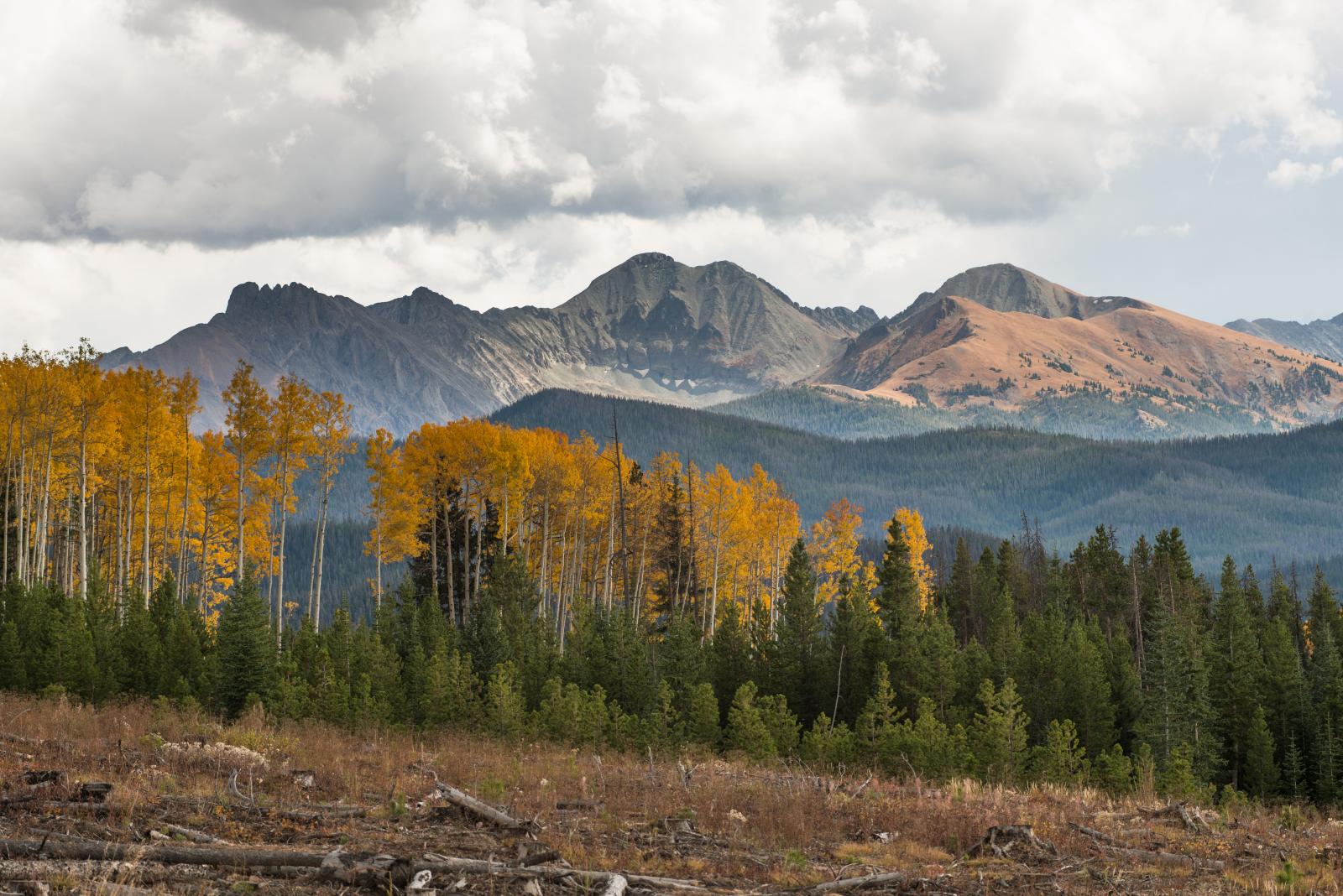
State Forest State Park offers visitors a high-mountain experience, with acres of forest, jagged peaks, alpine lakes, wildlife and miles of trails. Visitors enjoy the outdoors with activities like camping, hiking, horseback riding, cross-country skiing, snowshoeing, snowmobiling, fishing, hunting, birding and geocaching.
The main attraction at State Forest is water. The park offers the North Michigan Reservoir, where visitors can enjoy water activities. Many lakes can be found at State Forest, but Lake Agnes stands out as a favorite. This gem sits around 10,600 feet in elevation, and you can reach its shores with just a short hike of less than a mile during the summer season.
Over 80 miles of trails are open to off-highway vehicles. Motorized vehicles must remain on designated roads, and OHVs are not allowed in the campgrounds except to enter and exit each campsite. There are over 60 miles of snowmobile trails, including groomed trails, hillclimbs and meadows.
Moose is our claim to fame. State Forest State Park is well known for moose viewing throughout the year. North Park is considered the moose-viewing capital of Colorado, with over 600 moose observed year-round.
Set along the shore of North Michigan Reservoir, camper cabins complete a summer or winter vacation. The cabins range from smaller cabins that sleep a maximum of six to the Old Camp Pennock Lodge and Columbine Lodge, which sleep up to 21 and 15, respectively.
Aug
3
Aug 3, 2026 · 5:00am - Aug 3, 2026 · 10:00pm
To celebrate Colorado Day and the state's 150th birthday, Colorado Parks and Wildlife (CPW) is offering free entry to all...
Aug
3
Aug 3, 2026 · 5:00am - Aug 3, 2026 · 10:00pm
To celebrate Colorado Day and the state's 150th birthday, Colorado Parks and Wildlife (CPW) is offering free entry to all...
Sep
10
Sep 10, 2026 · 6:00pm - Sep 10, 2026 · 7:00pm
We're hiring! Join us on Zoom on Thursday, Sept. 10, 2026, at 6 p.m. for a Q&A about the hiring process to become a Parks or...
Sep
10
Sep 10, 2026 · 6:00pm - Sep 10, 2026 · 7:00pm
We're hiring! Join us on Zoom on Thursday, Sept. 10, 2026, at 6 p.m. for a Q&A about the hiring process to become a Parks or...
Aug
3
Aug 3, 2026 · 5:00am - Aug 3, 2026 · 10:00pm
To celebrate Colorado Day and the state's 150th birthday, Colorado Parks and Wildlife (CPW) is offering free entry to all...
Aug
3
Aug 3, 2026 · 5:00am - Aug 3, 2026 · 10:00pm
To celebrate Colorado Day and the state's 150th birthday, Colorado Parks and Wildlife (CPW) is offering free entry to all...
Sep
10
Sep 10, 2026 · 6:00pm - Sep 10, 2026 · 7:00pm
We're hiring! Join us on Zoom on Thursday, Sept. 10, 2026, at 6 p.m. for a Q&A about the hiring process to become a Parks or...
Sep
10
Sep 10, 2026 · 6:00pm - Sep 10, 2026 · 7:00pm
We're hiring! Join us on Zoom on Thursday, Sept. 10, 2026, at 6 p.m. for a Q&A about the hiring process to become a Parks or...
Hiking, Biking and Horseback Riding
Pristine mountain beauty greets visitors and provides an ideal setting for hiking and mountain biking opportunities. There are over 90 miles of hiking trails and 130 miles of mountain-biking trails. Horse corrals are located at the Bockman Campground and at the end of CR-41 at the Canadian River Trailhead.
The Michigan Ditch Trail and segments of the American Lakes Trail are closed to all users through late fall. The closures are in place for public safety while work on the Michigan Ditch Pre-Fire Mitigation Project is being completed in the Michigan Ditch drainage by Colorado State Forest Service and the City of Fort Collins. Read the news release for more information.
0.8 miles one way
Hiking, cross-country skiing, snowshoeing
6.5 miles roundtrip
Hiking, horseback riding, biking, cross-country skiing, snowshoeing
1.5 miles roundtrip
Hiking only
5.5 miles one way
Hiking, horseback riding, biking, cross-country skiing, snowshoeing, snowmobile riding
6.5 miles one way for Kelly, 7 miles one way for Clear Lake
Hiking, horseback riding, biking, cross-country skiing, snowshoeing, snowmobile riding
4 miles one way
Hiking, horseback riding, biking, motorcycling, ATV, Jeep, skiing, snowshoeing, snowmobiling
7 miles one way
Hiking, horseback riding, biking, motorcycling, ATV, Jeep, snowmobile riding
7 miles one way
Hiking, horseback riding, biking, motorcycling, ATV, cross-country skiing, snowshoeing
6 miles one way
Hiking, horseback riding, biking, motorcycling, ATV, Jeep, cross-country skiing, snowshoeing, snowmobile riding
4 miles one way
Hiking, horseback riding, biking, motorcycling, ATV, Jeep, cross-country skiing, snowshoeing, snowmobile riding
8 miles one way
Hiking, horseback riding, biking, motorcycling, ATV, Jeep, cross-country skiing, snowshoeing, snowmobile riding
Horse corrals are located at the Bockman Campground and at the end of CR-41 at the Canadian River trailhead. Call the park at 970-723-8366 to reserve.
Red Feather Outfitters offers horseback riding opportunities, and Medicine Bow Outfitters offers backcountry horseback trips.
The Bockman Horse Corral has four sections, allowing three horses in each section. The corral trail is accessible and located between site 309 and 311 on the east side of Bockman Campground.
The corral at the Kelly/Clear Lake trailhead has 18 stalls. Camping is available next to the corral by reservation only. Hitching rails are available.
Most of Colorado's outdoors is multi-use and intended to be shared. Hunters and nonhunters should show respect and courtesy to all users engaged in outdoor recreation.
Hunting is allowed in game management units 6 and 171 within the park.
Contact these licensed hunting outfitters for guided hunts within the park:
Rentals
Park visitors can rent activity equipment at the Moose Visitor Center.
The Visitor Center has:


