Designated Natural Areas contain a wide representation of Colorado’s rare plants and animals, unique plant communities, rich fossil locations, and geological features. Ownership of these sites include all types, such as private land, land trusts, local, state and federal lands. Visitation and recreational opportunities are at the discretion of the property owner.
Colorado Natural Areas and Significant Features Map
-
Open the map in a new window or tab.
-
Please be patient while the map loads.
-
For the best viewing experience, use a laptop or desktop computer.
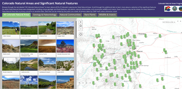
Overview of the Natural Areas System
-
96 Designated Sites
-
183,939 acres
-
Designations in 40/64 counties
-
Elevations ranging from 3,670 to 14,034 ft
See the full map of Designated State Natural Areas.
Land Ownership of Designated Natural Areas
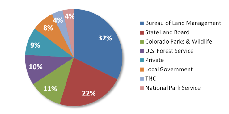
Land ownership of designated natural areas is displayed in the graph above by owner: 32% Bureau of Land Management, 22% State Land Board, 11% Colorado Parks and Wildlife, 10% U.S. Forest Service, 9% Private, 8% Local Government, 4% The Nature Conservancy (TNC), 4% National Park Service.
Significant Features within Designated Natural Areas
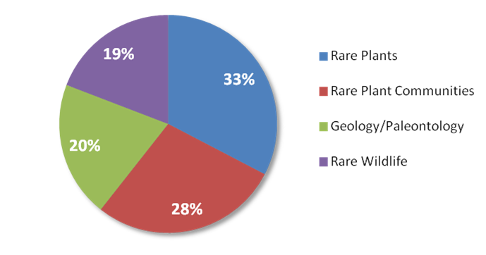
Significant features within designated natural areas is displayed in the graph above by type: 33% Rare Plants, 28% Rare Plant Communities, 20% Geology/Paleontology, 19% Rare Wildlife.


