The
Coyote Ridge Interpretive Trail is located just off the Coyote Ridge parking lot. The 1.35 mile self-guided nature trail loop winds its way along a low, easily hiked ridge and through several micro-ecosystems found in the hills and meadows. Pets (on a leash and under physical control) are welcome.
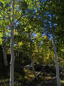 The Coyote Ridge Trail splits into two loops (Ponderosa and Aspen) that intersect in the middle. For a map of the park's trail system, view the
Trail System Map.
The Coyote Ridge Trail splits into two loops (Ponderosa and Aspen) that intersect in the middle. For a map of the park's trail system, view the
Trail System Map.
In summer, guided nature hikes with park interpreters are available; check the
calendar for more information.
Birders can download the
bird list brochure for both Eleven Mile and Spinney Mountain parks. A
plant list brochure is also available for those who are interested.
 The Black Bear Trail is 0.6 miles long and is considered a moderate hike. It spurs off of the Midland Trail and travels around the perimeter of the backcountry camping area. It explores the beautiful backcountry peninsula as it winds its way through the 25 secluded backcountry campsites. The trail consists of a few areas that require a scramble across bare rock or up uneven stone steps.
The Midland Trail begins at the far north end of the Coyote Ridge Trail's Aspen Loop and returns to the Coyote Ridge Parking Lot, passing the Black Bear Trail and Backcountry Campground along the way. This easy to moderate (it has a few small hills to climb) section of trail adds 2.9 miles to the existing trail system.
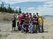 We thank the Volunteers of Outdoor Colorado (VOC) and the Colorado Youth Corp Association for their help in constructing the trails. Eagle Scouts, leading their Boy Scouts of America troops, completed all of the trail signing and we thank them as well. Eleven Mile State Park would also like to recognize the fine work done by the Southwest Conservation Corps (SWCC) on the park's trails for the past decade. SWCC comes out to the park for a couple weeks each summer to assist in maintaining the existing trail features and improve them wherever possible.
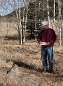 In 2008, the park installed an orienteering trail. This 3.16 mile trail is a bit different than one with a constructed pathway to follow. Instead, it is an orienteering course that can only be located by following a predetermined set of instructions with a compass. It was planned and constructed as an Eagle Scout project by the Boy Scouts of America Troop #198. The course begins and ends at the same spot; a point marked with a sign near Backcountry campsite #901 and has 9 main waypoints and a total of 41 subpoints that must be navigated successfully to complete the course. Directions for the course are contained in the Orienteering Trail Brochure that also contains GPS positions for each subpoint. The
Eleven Mile Orienteering Trail Brochure may be obtained by downloading it here or stopping by the park office.
In 2008, the park installed an orienteering trail. This 3.16 mile trail is a bit different than one with a constructed pathway to follow. Instead, it is an orienteering course that can only be located by following a predetermined set of instructions with a compass. It was planned and constructed as an Eagle Scout project by the Boy Scouts of America Troop #198. The course begins and ends at the same spot; a point marked with a sign near Backcountry campsite #901 and has 9 main waypoints and a total of 41 subpoints that must be navigated successfully to complete the course. Directions for the course are contained in the Orienteering Trail Brochure that also contains GPS positions for each subpoint. The
Eleven Mile Orienteering Trail Brochure may be obtained by downloading it here or stopping by the park office.


